The 13 Best Hikes In Edinburgh
Thinking about the best hikes in Edinburgh as you land at Edinburgh Airport? Located between the Firth of Forth and the Pentland Hills, the Scottish capital has hundreds of miles of hiking trails from easy walks to seriously rugged hiking expeditions. No matter what kind of trip you want to take in Edinburgh, you can always find a walking or hiking trail to get you there.
There are seven main hills in Edinburgh including Calton Hill, Arthur's Seat, Blackford Hill, Braid Hill, Craiglockhart Hill, Corstorphine Hill, and Castle Rock. In fact, you can start at the city center and hike up to Arthur's Seat in Holyrood Park by way of the Royal Mile for stunning panoramic views. Or take a shorter hike up to Calton Hill where you can see the National Monument of Scotland.
Castle Rock is one of the most popular, of course, with famous attractions and spectacular views from the top. The huge rock rises through the city center with many paths shooting off the main trail that will take you to different areas of Edinburgh, Scotland. Try the woodland walk in Blackford Hill Nature Reserve where you can see for miles. The climb is easier than Arthur’s Seat and Calton Hill while still offering a great view.
If you would rather take an easier and flatter hike, try the Water of Leith Walkway or Union Canal. The Iron Age Hill Fort is not a difficult hike and there have been many archaeological excavations there with Roman artifacts found. Head to the Pentland Hills National Park for a walk around the Threipmuir Reservoir. This moderate loop trail in the Pentland Hills near Juniper Green meanders along the water's edge.
Wherever your walk takes you, you will not want to bring your bags along so find a facility for luggage storage in Edinburgh to take care of them for you. Then you can enjoy your hike without worrying about the safety of your belongings. But don't forget to take your camera so you can get some pics of the stunning views.

Love discounts and traveling?
Sign up for our newsletter and get 10% off your next booking.

Our Top Hiking Trail Picks in Edinburgh
Arthur's Seat
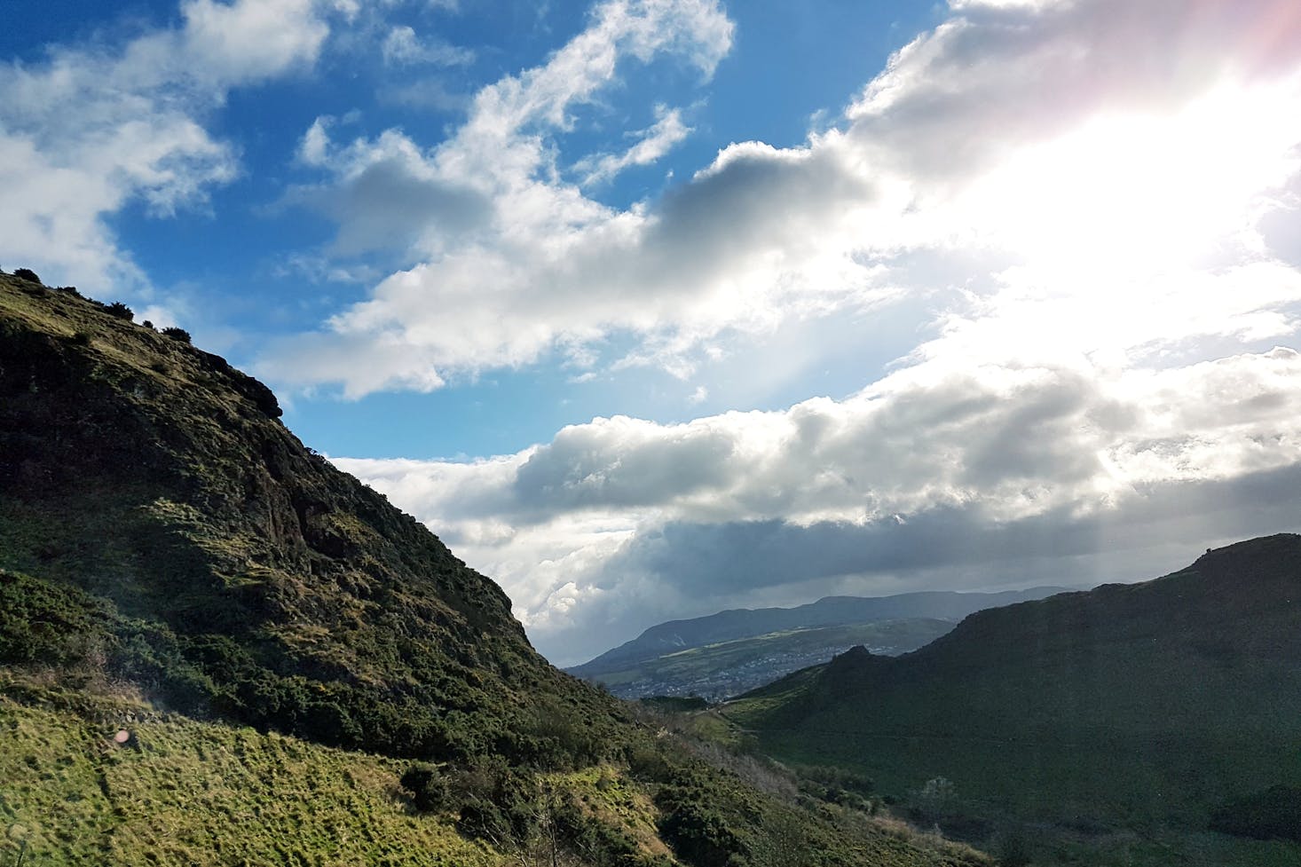
Arthur's Seat is not a hill per se; it is a huge volcano that looks similar to a lion in Holyrood Park. Don't worry, it is an extinct volcano so you can travel on it safely. The bottom of the hill is just a 20-minute walk from the city center and there are several trails you can explore on this massive rock. Whether you want to go see the Crater of Vulcan or the other hiking trails, this is the top hiking spot in Edinburgh.
The hiking route includes a stroll along Salisbury Crags with a marvelous view of the Scottish Parliament building. The towering cliffs were created during a volcanic eruption about 325 million years ago. In 1836, a group of boys headed out to the hills of Arthur’s Seat to hunt when they found a small cave with 17 mini coffins hidden behind three blocks of slate. You can see eight of these in the National Museum of Scotland in the historic old town of Edinburgh.
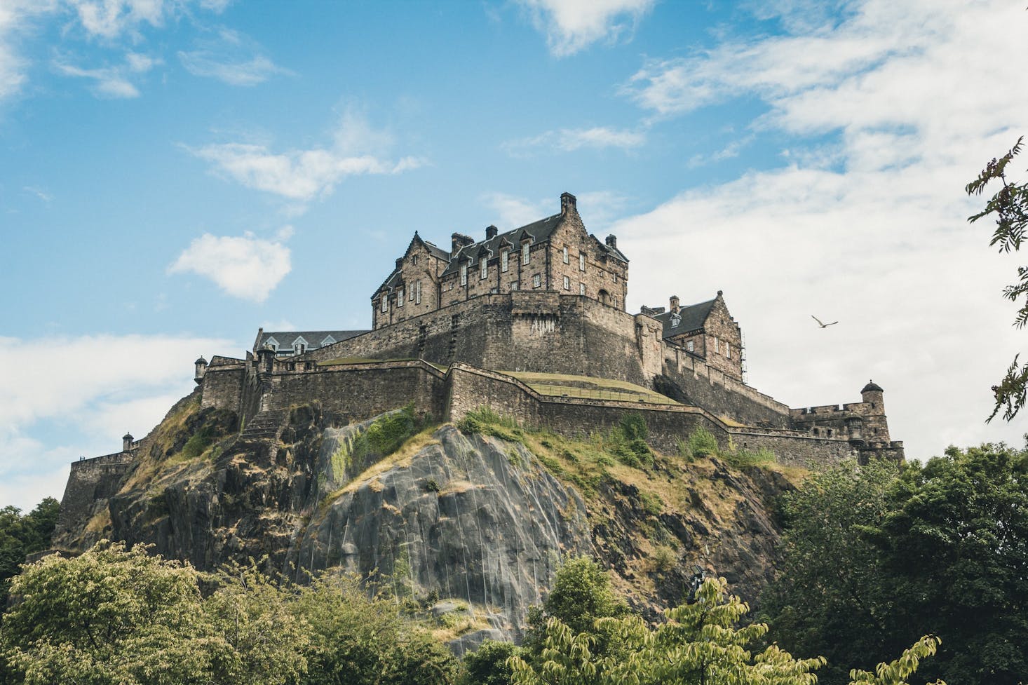
Castle Rock
Castle Rock is a lava neck or volcanic plug in the middle of Edinburgh where the Edinburgh Castle sits. It is estimated to be more than 350 million years old, created during the Carboniferous period. The rock is what remains of a volcanic pipe that cut through the surrounding rock before it cooled and formed a hard type of basalt. It is also a fantastic place for a hike.
The castle was the home of many kings and queens over the centuries including Sir Walter Scott. In fact, Queen Margaret died there in 1093 and the chapel built by her son, King David I, in her honor is the oldest building in Edinburgh. These are some of the best hiking trails in the area so you should not miss this place right near Arthur's Seat.
Calton Hill
Do you adore museums and history? Also by Arthur's Seat with access to the castle, Calton Hill is set right in the city center with its unmistakable Athenian acropolis sticking up above the skyline. It is an unfinished monument begun in 1816, a year after Napoleon was defeated at Waterloo. It was supposed to be a replicated Parthenon like the one in Athens for a memorial to those who died in the wars.
The Old Calton Burial Ground is a UNESCO World Heritage Site and was the first thing built on the hill. The cemetery is the final resting place of David Hume, buried in 1776. There are also two observatories on top including the City Observatory, built back in 1818, and the Old Observatory House built back in 1792. Both of these spots are great ways to view the night sky as well as the stunning scenery all around them.
Braid Hills
The Hermitage of Braid was named after a 1700s estate, the Hermitage House, with stables, an icehouse, a walled garden, and a historic dovecot. Hiking in the Braid Hills along several trails, you will find the Hermitage House with a visitor center at the front of the park. The Braid Hills comprise a section on the southwestern edge of Edinburgh. The hills themselves are lush areas of open green space.
The area was owned by the de Brad family until the 1700s when it was bought by Charles Gordon of Cluny. Years later, the land was presented to the city as a public park in 1937. The Braid Hills Hotel looks out above Pentland Terrace overlooking the park across the road. It is known for its spectacular city views and popular golf course where kids go sledding in the winter.
Blackford Hill
Blackford Hill is just to the northeast of the Pentlands and was formed from Lower Devonian volcanic rocks between Upper Devonian sandstone. In 1884, it was bought by the Edinburgh Corporation, and the nearby Hermitage of Braid estate was gifted to the city in 1938 by John McDougal, its owner. The hill has awesome views of Edinburgh and the Pentland Hills.
Along with the Hermitage of Braid, the area makes up the 149-acre Hermitage of Braid and Blackford Hill Local Nature Reserve where you can also see Hermitage House. Do not miss the ancient hill fort on the summit part of the hill though. It is protected as a Scheduled Ancient Monument and is a fun place for selfies.
Craiglockhart Hill
There are two parts of this hill, which are made up of the Western and Eastern Craiglockhart Hill, both of these easy and popular trails. The Easter Craiglockhart Hill is 518 feet high, and Wester Craiglockhart Summit is 574 feet high. Built from basaltic ash and lava on sandstone, the hill has some very unique columns of exposed lava.
The gorgeous green valley between the two summits is referred to as Glenlockhart. It was formed approximately 17,000 years ago when there was an ice sheet over the area. The melted water from the Water of Leith cut the channel when it was dammed by ice. You will also meander along the Craiglockhart Pond during some of your walk.
Corstorphine Hill
At 528 feet above sea level, Corstorphine Hill is found on the western edge of Edinburgh. There are several ways to get up the hill so depending on which way you go, your hike may be strenuous and rugged or easy and calm. Most of the hill is inside a local reserve of woodlands and green spaces.
The hill, which is composed largely of dolerite, was formed during the Pleistocene Period with the movement of glaciers from east to west. There has been evidence of prehistoric inhabitants in some areas that are protected. Some of the neat features are a Cold War bunker, a walled garden, and a tower from the 1800s. It also provides an enjoyable walk through the woods with excellent views looking out over the Firth of Fifth.
Easy Hikes in Edinburgh
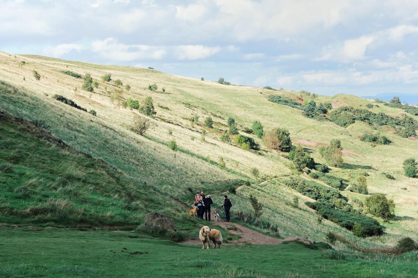
Pentland Hills Regional Park
The Regional Park has about 22,239 acres with a variety of different sized hills from Patie's Hill to Turnhouse Hill with West Kip and East Kip in the middle. The main ones include Castlelaw Hill at 1,601 feet, Carnethy Hill at 1,880 feet, and Scald Law at 1,900 feet.
The park stretches from Edinburgh to Carlops with an array of popular activities such as golf, horseback riding, biking, walking, and hiking. Some of the most popular hiking trails include the Harlaw Woodland Walk, which is an easy two miles, Torduff Water is a moderate 1.5 miles, Capital View is a moderate 2.5 miles, and Great Glen Mystery, which is a moderate 2.7 miles.

The Water of Leith Walkway
The Water of Leith Walkway is a nice long path through the heart of the city center. It is 12 miles long but there are many stops to enjoy a break along the way. It follows alongside the banks of the river with a variety of points of interest popular with locals as well as visitors. It is a fantastic way to see the city and enjoy some exercise as well.
It begins in Leith and ends in Balerno and West Linton with a smooth path for the most part, although some spots may be a bit muddy or cobbled, depending on the time of year and the weather. It takes you through some of the best neighborhoods like Stockbridge and Dean Village. You can even visit the Glasgow Gallery of Modern Art along your walk or have a drink at one of the pubs or cafes. Or head back into the city for some Edinburgh street food.
Intermediate Hikes in Edinburgh
Dry Dam Path
This 2-mile trek to Saint Anthony's Chapel is a challenging route in Edinburgh, Scotland that boasts spectacular scenic views, parkland, and beautiful wildflowers and is rated as intermediate. The rocky summit gives you a panoramic view of the skyline. You may even catch a glimpse of a few deer, the Highland Cow, or a capercaillie.
The group of hills is rocky and wild and has an elevation gain of about 640 feet. From here you can get to Arthur's Seat to see the west coast, Holyrood Park, Old Town, and the Union Canal. It is truly a spot to get away from the hustle and bustle for some peace and quiet.
North Berwick Law
North Berwick Law is an intermediate 1.3-mile hike with stellar views of the town of North Berwick. It is a steep volcanic plug that has survived the glaciers of the ice age. The summit features the remains of a historic military fort that was used as an observation post during the Napoleonic Wars and World War II.
A replica of a whale's jawbone is also found on the summit. The original was authentic and was placed there in 1709 but has been replaced three times since then. Besides North Berwick, you can also see the West Lothian Coast, Tantallon Castle, and Bass Rock. This is definitely one that is worth the trip.

Difficult Hikes in Edinburgh
Penicuik Circular Route
If you would like to spend a few days in the Edinburgh countryside, the Penicuik Circular Route is almost 46 miles and has a vast array of features. This one will take you several days at least with camping spots from rustic to modern.
You will find a beach area in Cammo Estate and Silverknows as well as some excellent paths along the Threipmuir Reservoirs and the Pentlands. Most of the path is rugged with an elevation gain of almost 5,300 feet.
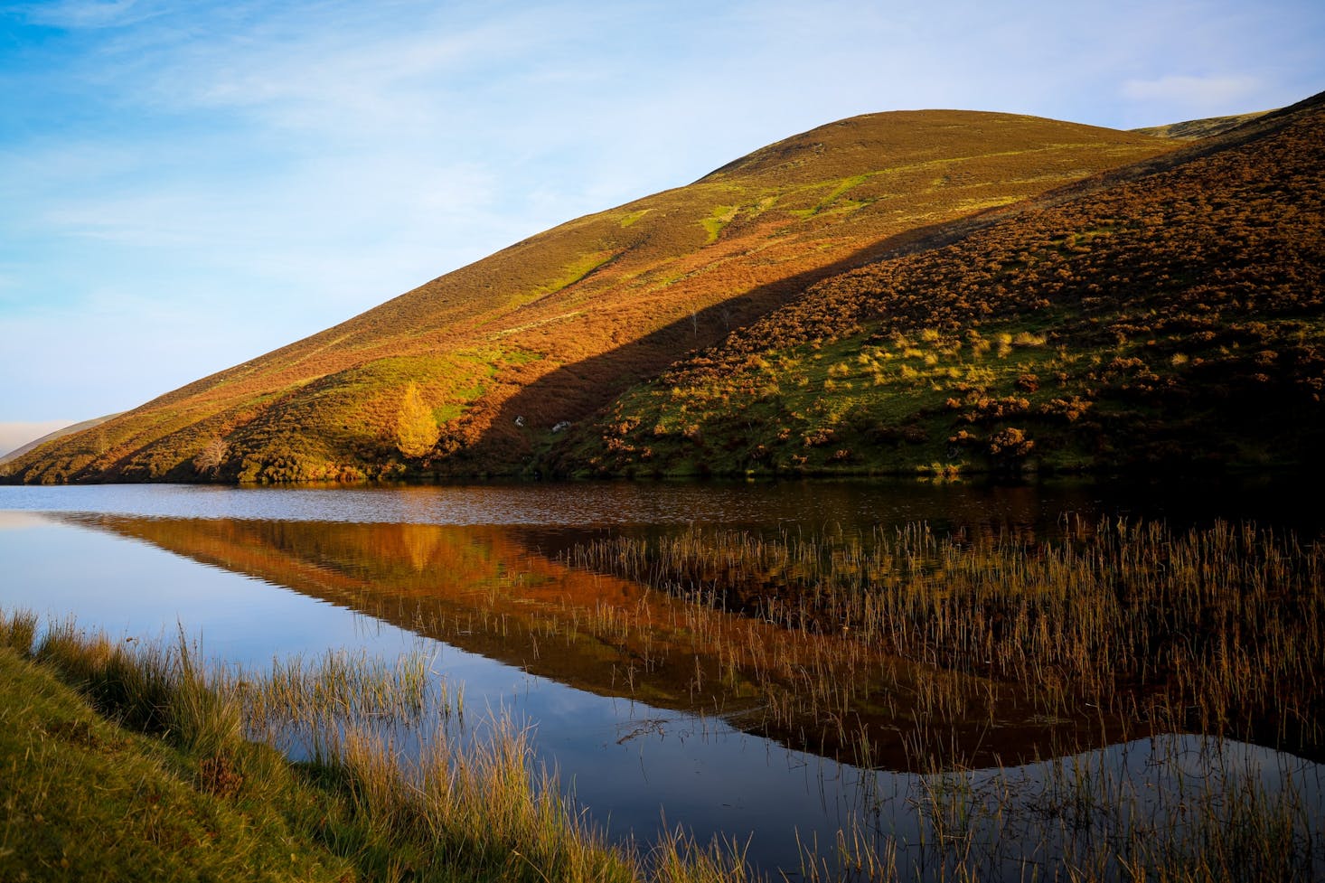
Pentland Ridge and Threipmuir Reservoir Circular
This 7.4-mile loop trail may be a lot shorter but it is no less difficult and has some spectacular features. Just to the south of Edinburgh, the breathtaking scenery from Allermuir Hill make the 1,886 elevation gain and rugged terrain worth it.
Take a walk along the ridges of the Kips, Scald Law, and Carnethy Hill where you might spot some of the mountain wildlife like goats, the Scottish wildcat, pine martens, and red deer. The forested trails are sometimes difficult to follow but when you get to the Bavelaw Castle, you will be so happy you came.
Great views in Scotland
These are some of the best hiking trails in the Scottish capital of Edinburgh, Scotland with some near Edinburgh City Centre while others are way off the beaten path. It is a good idea to bring a pack with extra water and snacks, a first aid kit, a compass, and other important items you may need on your journey. Extra shoes, a jacket, and a cell phone are some examples of things to bring when you do any Edinburgh hiking.
Love discounts and traveling?
Sign up for our newsletter and get 10% off your next booking.