How To Get Around Portland
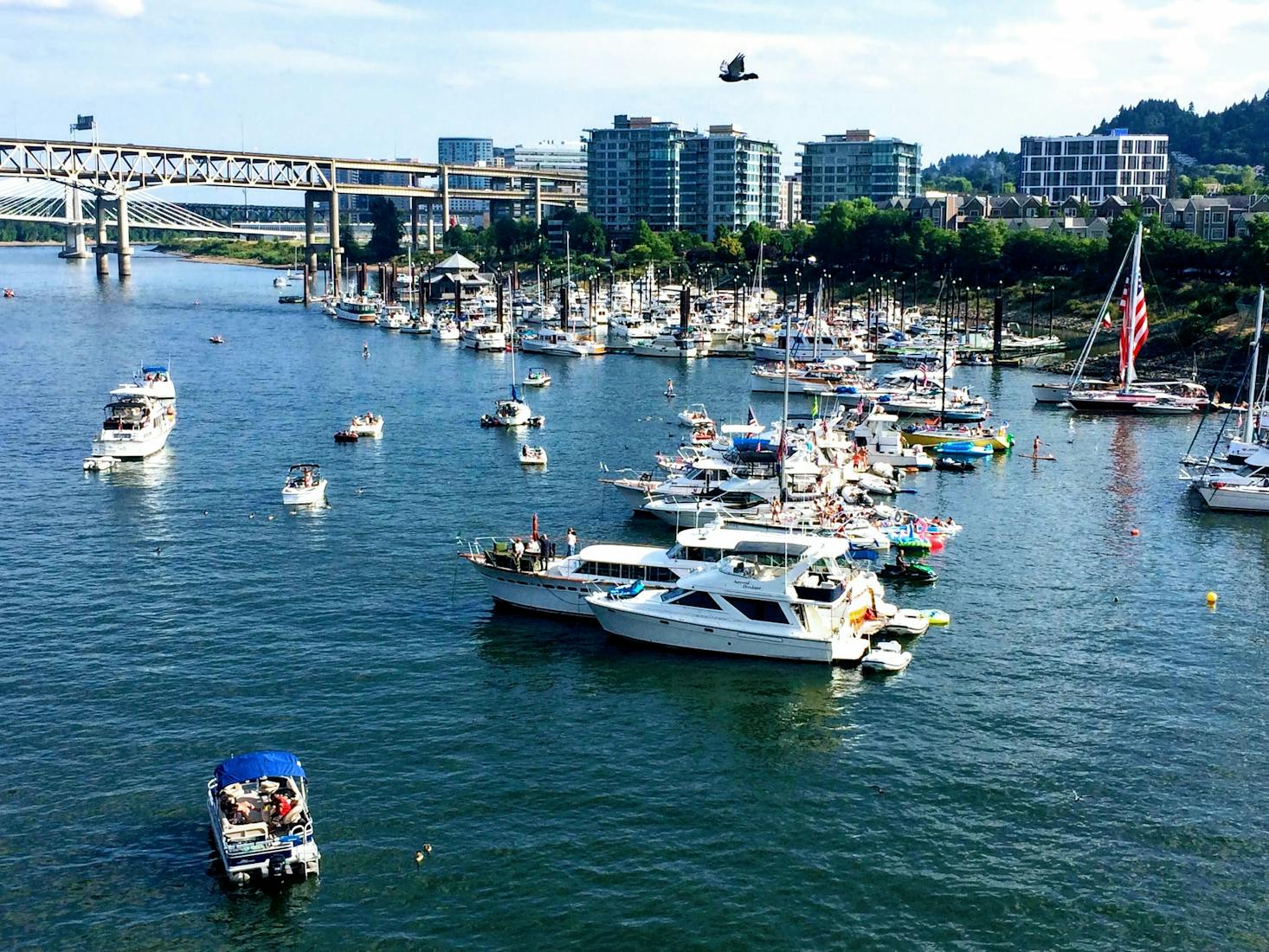
Portland is a city located in Oregon and is the U.S. state’s largest and most populous city. Sitting between the Columbia River and Willamette River, Portland’s proximity to water access made for easy transportation of goods, leading to the city becoming a major port for the Pacific Northwest. Although it was initially notorious due to rampant organized crime, its industrial boom post-Second World War led it to become one of the region’s most flourishing cities.
Nicknamed the “City of Roses”, because of its year-round climate that is ideal for growing roses, Portland is a buzzing city that has so much to offer – from its impressive street food and craft brewery scene to outdoor spaces and adventurous attractions. While it may have been overshadowed by the neighboring city of Seattle in the past, Portland has emerged as one of the most exciting destinations in the Pacific Northwest and the West Coast.
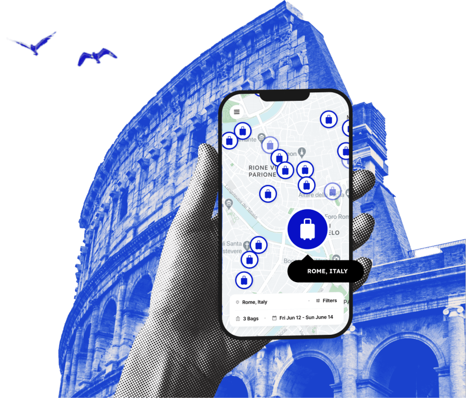
If you’re planning a trip to see what the city is all about, you’re in luck; this Oregon town prides itself on having an impressive public transportation system along with some of the country’s most pedestrian-friendly streets. From flying in via Portland Airport to using other forms of travel in the city, we've got you covered. If you’re planning to visit the city soon, check out our comprehensive guide on getting around Portland. Don’t forget to look for a Portland luggage locker where you can store your belongings so that you can explore the city more conveniently.
Love discounts and traveling?
Sign up for our newsletter and get 10% off your next booking.
How to get around Portland by train
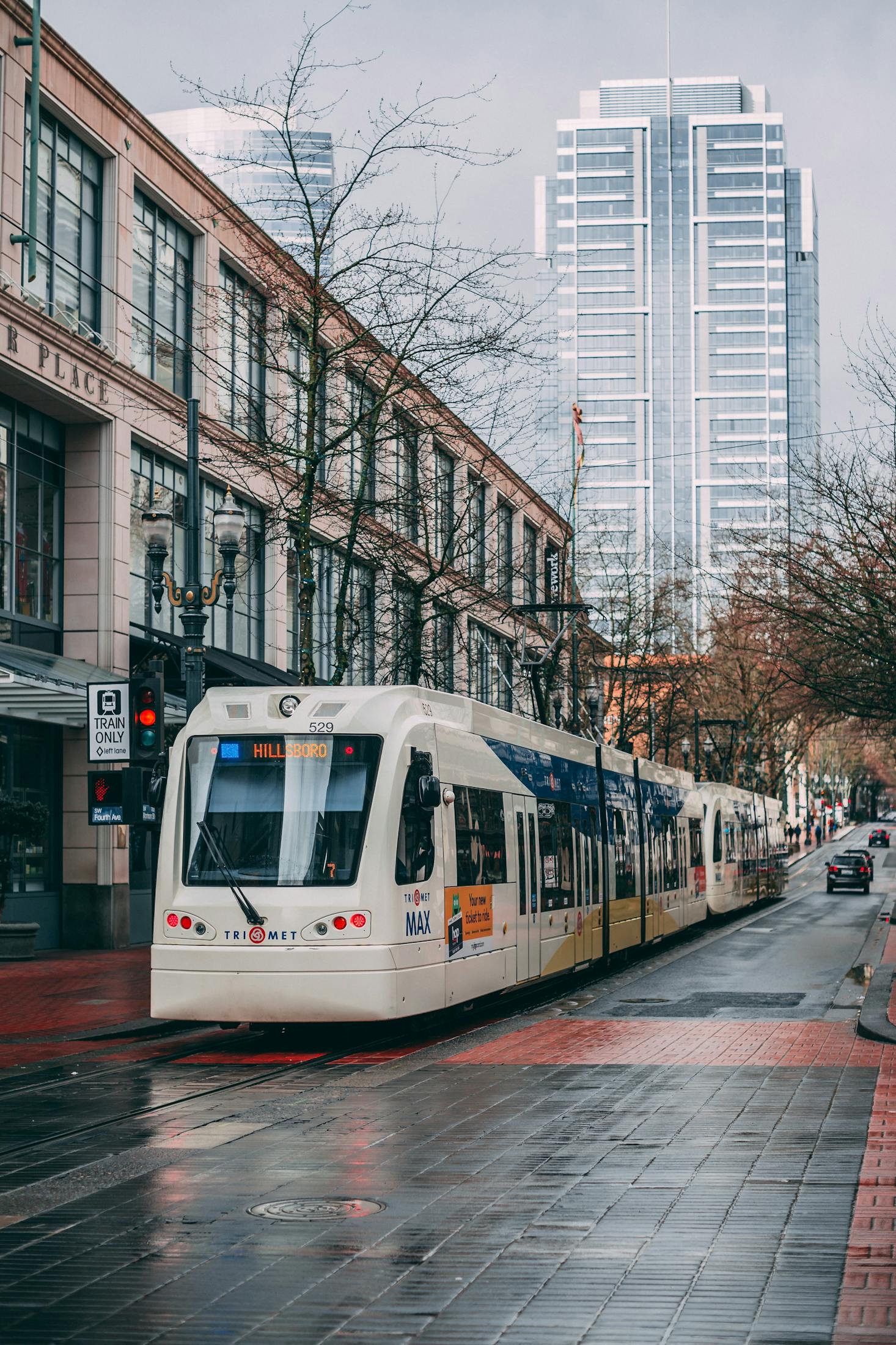
TriMet Portland, or simply TriMet, is the public agency that is responsible for operating the public transportation system in the Portland metropolitan area. Among the different modes that TriMet offers, perhaps the most convenient and popular option is the Metropolitan Area Express (MAX) light rail. During your time in Portland, you’ll most likely be utilizing the light rail more than any other mode of public transportation.
Considered the heart of Portland’s excellent public transportation system, the MAX light rail is comprised of 90 stations with a track that stretches for over 60 miles. MAX has five lines – Blue, Green, Orange, Red and Yellow – all of which pass through downtown Portland and connect the city center to Portland International Airport (PDX) and the greater Portland region.
Because it is frequently used by both locals and tourists, the MAX light rail system operates daily from 4:00 AM until just before midnight and runs on an interval of 15 minutes or less. Since the TriMet no longer accepts paper tickets, passengers can either pay online using a mobile wallet (e.g. Apple Pay, Google Pay, Samsung Pay) or through a reloadable Hop FastPass card, which can be bought in most convenience stores, pharmacies, supermarkets and other retailers around the city.

How to get around Portland by bus
The TriMet bus system is also another popular and convenient way of navigating Portland. At present, there are 84 bus lines that are serving Portland’s metropolitan area, each of which have numbers assigned to them to help passengers determine which areas they serve. One of the most popular bus lines, particularly among tourists, is Line 63 – Washington Park, which passes through some of the city’s famous attractions, including the Oregon Zoo, International Rose Test Garden and Hoyt Arboretum.
One of the most impressive things about the bus service is its special features; the TriMet buses offer full wheelchair accessibility and are also equipped with bike racks for cyclists who need to bring their bicycles in public transit. Similar to the MAX, TriMet bus tickets can be paid for using a mobile wallet or via Hop Fastpass. Buses run 24 hours a day, although the intervals differ depending on the time of the day. Look for the green symbols, which indicate the lines that have frequent service (15-minute intervals or less).
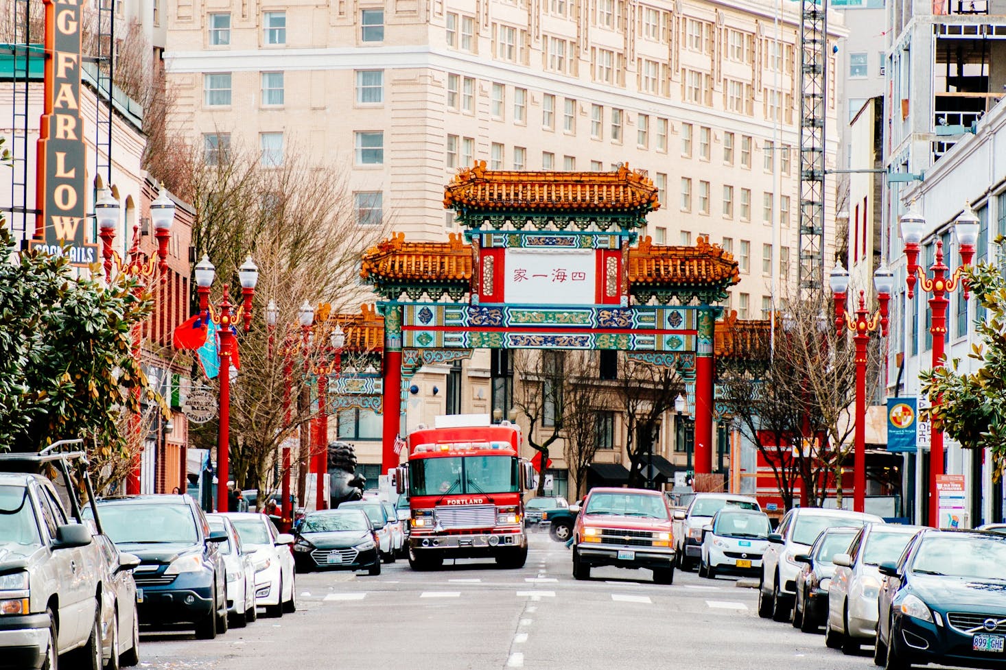
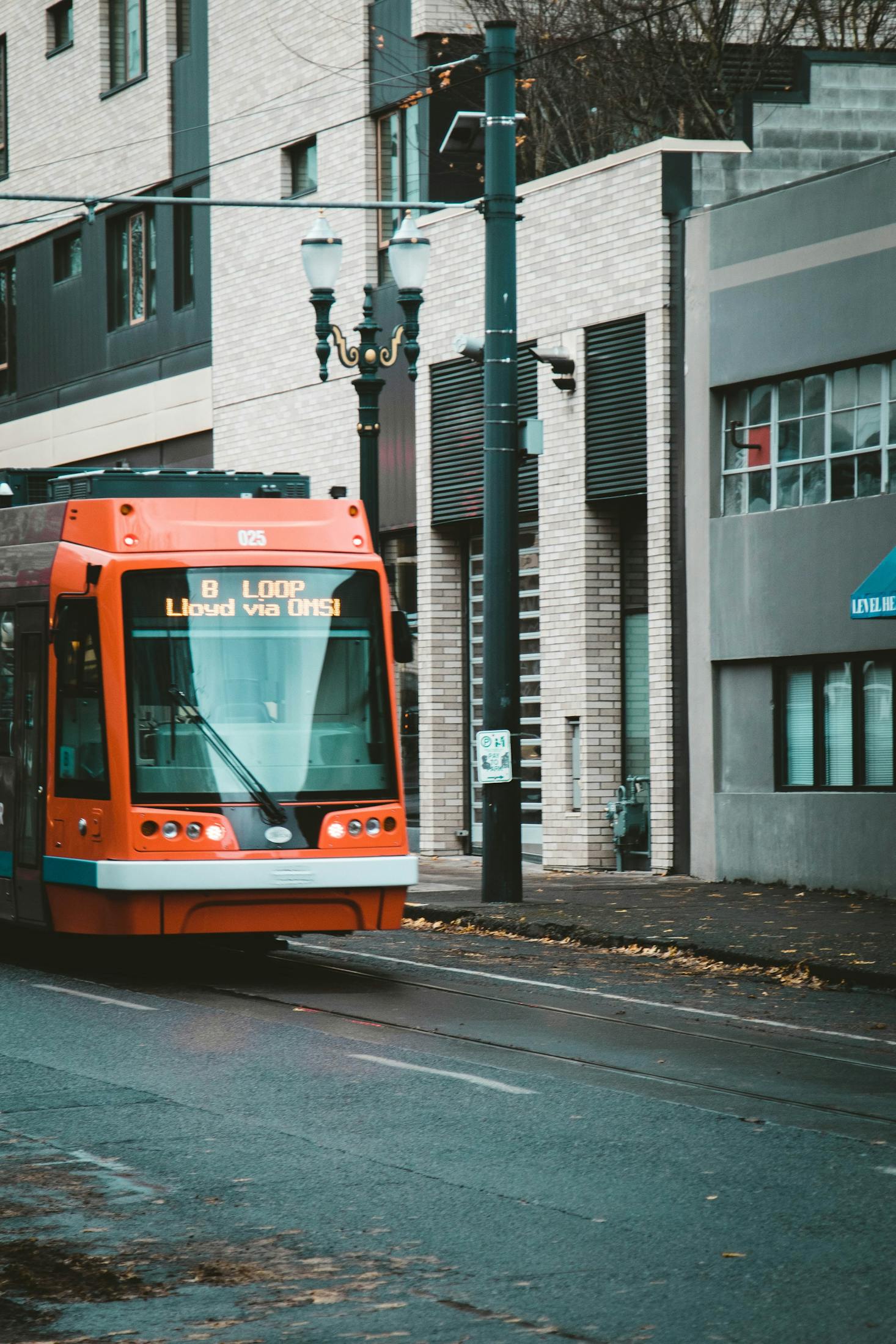
How to get around Portland by streetcar
Established in 2001, the Portland Streetcar is one of the most unique modes of public transportation in the City of Roses. Also managed and operated by TriMet, the Portland Streetcar is the first of its kind in the United States and one of the most frequently used public transport methods in the city.
The modern day streetcar network is composed of three lines – namely the North Shore (NS) Line, A Loop and B Loop – that pass through 16 miles of track in Portland’s Central City. The first ever streetcar line, the NS line runs from southwest to northwest Portland and vice versa. Meanwhile, the A Loop line runs in a clockwise direction and links the east and west sides of the city, with stops in several points of interest such as the Broadway Bridge, Pearl District, the Portland State University and the Tilikum Crossing. Finally, the B Loop line has similar stops as the A Loop but instead runs in a counter-clockwise direction.
While the Portland Streetcar does not cover the entirety of the city, it is an ideal option for moving around downtown Portland or getting to The Pearl District. Similar to the other TriMet public transportation systems, you can use your Hop Fastpass app or reloadable card to utilize the streetcar service. Streetcar fares range anywhere from $2.50 to $5, making it one of the cheapest transportation options.
How to get around Portland by taxi
Portland’s public transportation system is so impressive that taxis aren’t really an ideal option, except when you need something more private and convenient. Luckily, because the city is a bit compact in size, it won't be as expensive to book a cab ride to get to your destination. If you need to book a ride, there are plenty of reputable taxi companies that you can utilize while in the city. Arguably the most popular, Radio Cab has a fleet of taxis that can be hired; you can hail a cab in several stops around the city or call the company to book directly.
Other notable cab companies include Broadway Cab, Portland Taxi and Union Cab. If you’re environmentally conscious, you can opt to hire EcoCab, a fairly new taxi company that only uses electric vehicles. Although they typically charge a bit more for rides, you will be doing your part in reducing the harmful impact on the environment.
Recently, ridesharing has also become a popular option for both locals and tourists who want to move around the city. Rideshare companies such as Uber and Lyft are currently operational in Portland and can easily be booked via their respective mobile apps. However, note that these ridesharing apps only operate within the Portland metro area and some of the surrounding suburbs. Thus, if you're looking to go outside of the city to visit neighboring towns and cities, you will have to rent your own car.

How to get around Portland by car
While Portland boasts an amazing public transportation network, the city is notorious for its car traffic, especially during peak hours and during the busy seasons of the year. Hence, traveling in four-wheeled fashion isn’t really recommended, especially if you’re just staying within city limits. This is because, aside from the automobile traffic that you will be dealing with, parking fees can add up when you use any of the 15,000 metered parking spaces found all over Portland.
However, if you have plans to take day trips or visit nearby out-of-town attractions such as the Willamette Valley or Mount Hood, then you should definitely consider renting your own car. Fortunately, renting your own car in Portland is quite easy and there are many ways to do so. If you’re flying into Portland Airport, you can rent a car from the airport or you can wait until you get to downtown, where most major car rental companies are headquartered.
Another great option for renting a car is through car-sharing. The practice of car-sharing has existed in Portland since 1998 when a small company was established and would later on become part of Zipcar. The concept involves vehicles for rent parked all over the city and renters can reserve online or through the company’s mobile app. The payment is either on a per-mile or per-hour rate or renters may choose to pay a monthly or annual fee. Aside from Zipcar, other prominent car-sharing companies in Portland include Car2Go, Free2Move and GetAround.
How to get around Portland by bicycle
One of the best ways to get around Portland is on two wheels. As a matter of fact, cycling is one, if not the most preferred mode of transportation by the locals. Riding a bike to explore Portland poses many advantages; aside from the health and environmental benefits that cycling offers, there are also several sites in the city that can only be accessed via bike or on foot, such as the Tilikum Crossing and the Tom McCall Waterfront Park.
The best part is that you don’t have to fear for your safety because the city is extremely cyclist-friendly. Portland has over 350 miles of protected bike lanes and has the highest percentage of cyclist commuters in the United States. Because of its reputation as a bike-friendly city, Portland has no shortage of bicycle rental companies where you can rent a ride during your time in the city.
In 2016, the city also launched the BIKETOWN bike-share program, which offers over 1,000 bikes for rent located in more than 100 stations found all over Portland. Through this program, you can borrow a bike and pay by the minute or pay for long-term rental. If you want to ride something a little less tiring, electric scooters are also becoming popular among and being offered for rent by companies like Spin and Lime.

Can I get around Portland by foot?
One of the best and money-saving ways to explore Portland is to go for a walk. While this may seem like an unappealing option to some, it is actually the best way to move around if you’re just staying within the city center and downtown Portland, which are easy enough to navigate on foot. Going on foot can start to become more challenging once you go east or west of the city, where there are a lack of pedestrian-friendly spaces and steep hills.
Apart from the vibrant downtown, the City of Roses has several walkable neighborhoods such as Hawthorne (see why to stay in Hawthorne here) and Alberta Arts District, which are all generally flat and where you can discover a multitude of lovely sites and wide green spaces. The Portland Bureau of Transportation has also outlined an array of walking paths that both locals and tourists may utilize.
One of the key places to visit when exploring on foot is the Tilikum Crossing, which connects the Central Eastside to the South Waterfront and is the only bridge in the U.S. with no automobile traffic. There are also a number of walking tours being offered around the city – anything from general sightseeing tours to food walking tours.
Accessible travel in Portland
Portland has put in a great deal of thought into making public transit accessible for everyone, including travelers with disabilities. This is evident in the different modes of public transportation in the city; for instance, the train stations have ramps for easy access and public buses have power lifts and boarding ramps for wheelchair users. The city also has an initiative known as LIFT Paratransit, which is a shared-ride service designed for passengers who are unable to access public transportation due to disabilities or other health conditions.
Moreover, to make cycling more accessible to people with disabilities, BIKETOWN launched Adaptive Biketown. In this program, special bicycles (e.g. electric assist bikes, hand-powered bikes, multi-person bikes) are rented out to cater to a variety of disabled passengers at discounted rates.
Love discounts and traveling?
Sign up for our newsletter and get 10% off your next booking.