The 10 Best Hikes In Malaga
In the South of Spain by the Mediterranean Sea is the city of Malaga. It was founded nearly 3000 years ago by the Phoenicians and is situated in the Andalucia region, which is also called Costa del Sol. Malaga is actually Spain's fifth largest city and is calm and relaxing, making it a great spot for a vacation and also a nice place to live. People often know Malaga for its nice weather, beautiful beaches, golf courses and historic buildings, but it is also Southern Spain's top business center.
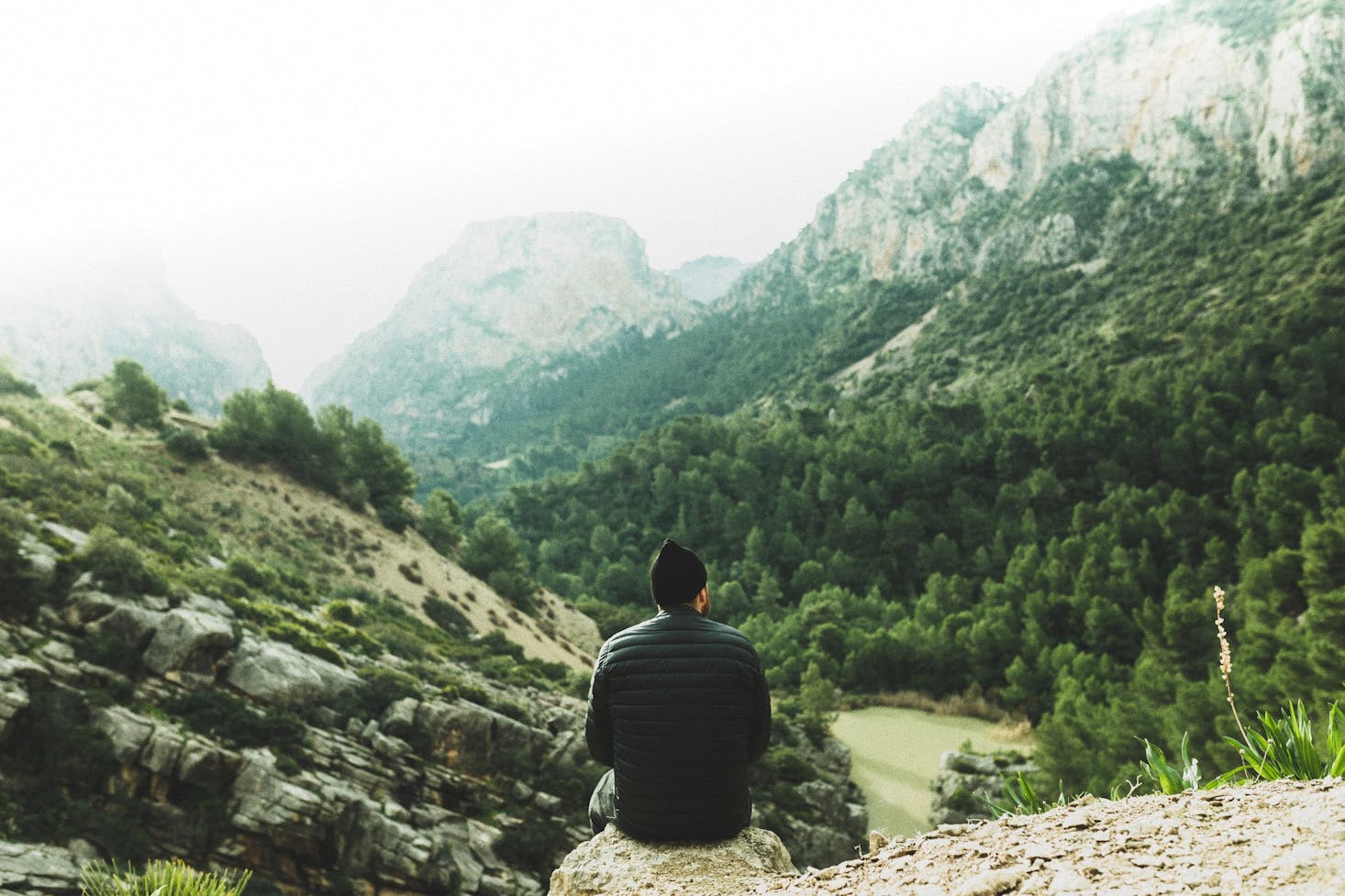
Aside from museums and tourist attractions in Malaga, visitors can enjoy walking around the city streets or hiking in the surrounding landscapes and greenspaces. Below, we have listed some of the best hiking trails and national parks around the city so you can enjoy nature and spend time outdoors during your vacation. Before setting off for the hiking routes you should stow your extra gear, like backpacks and bags, away at a suitcase locker in Malaga.

Love discounts and traveling?
Sign up for our newsletter and get 10% off your next booking.
Our Top Hiking Trail Picks in Malaga
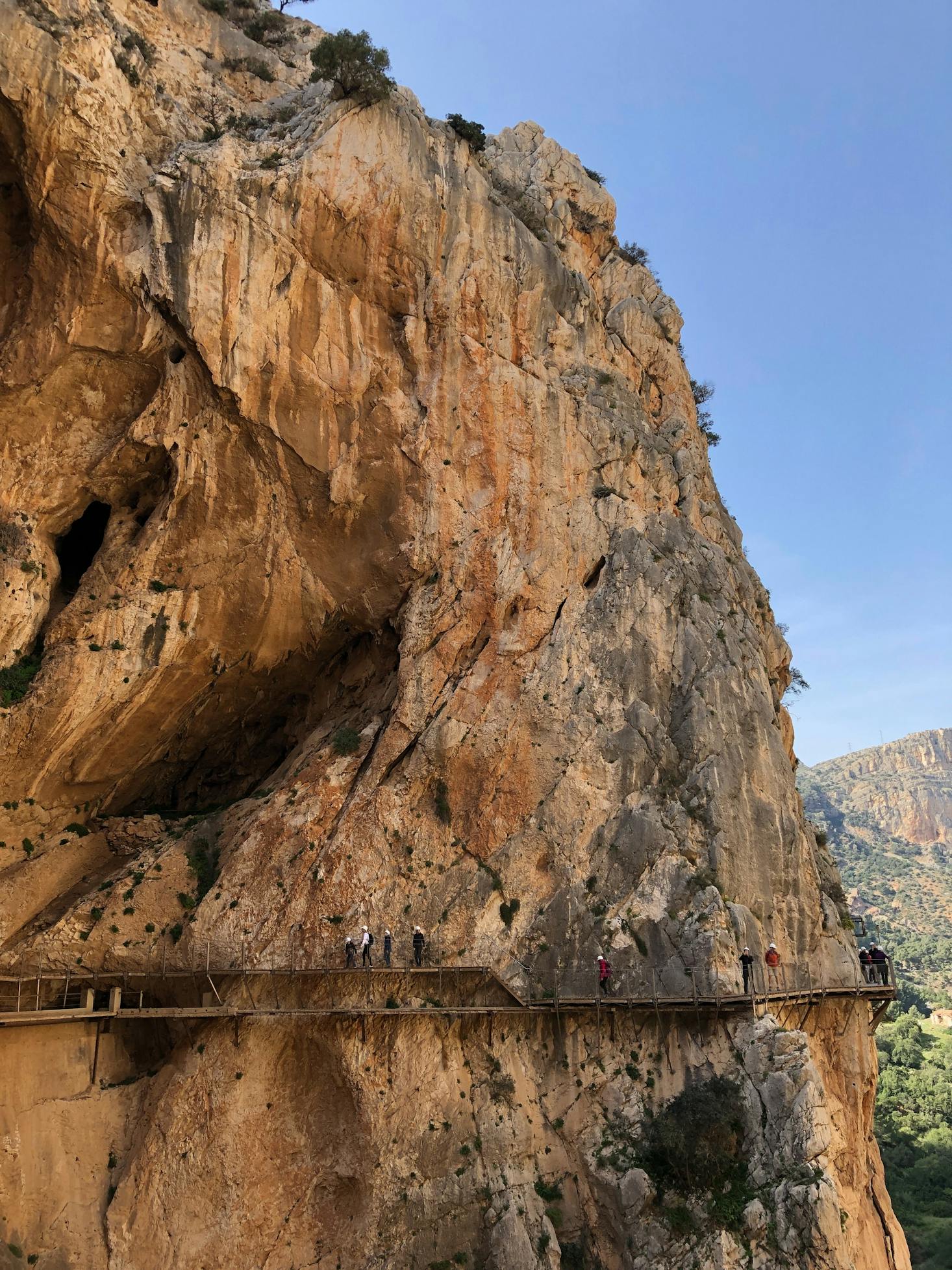
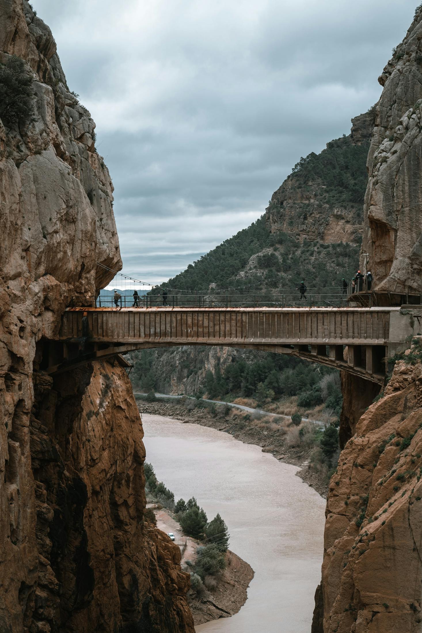
El Caminito del Rey
One of Spain's most famous hikes of all is the El Caminito del Rey which spans about 7.7 kilometers. Although the path does not experience much elevation gain it does have areas that pass by the wall of the gorge and are 100 meters above the ground, which is why this trail is not recommended for people who are afraid of heights.
Before the path was renovated in 2015 it was one of the most dangerous hikes in the world, which is why you have to purchase a ticket and wear a helmet before entering the trail. You will be given a safety briefing before starting the hike and there are people stationed along the path to ensure that everything is okay, so you can be confident that you are in good hands. Overall the hike takes about two hours but you will need an extra hour or so to get there since it is a one-way path and you have to take a bus to where the trail starts. Start from the Malaga bus station. The hike is located about an hour away from the city centre.
La Maroma
Welcome to the highest peak in all of Malaga, which is found on the La Maroma mountain. It is an iconic mount in the Sierra de Tejeda and Sierra de Almijara mountain ranges of the Alhama Natural Park, so you shouldn't have too much trouble finding it. The hike reaches an elevation gain of around 1,500 meters and there are three different routes that you can take to get here.
Your first option and also your easiest choice begins at the Alhama de Granada and is called the Robledal. The Sedella path has two routes; one which is the shortest and the other which is longer and the most difficult way to get to La Maroma. Lastly, you can take the trail from Canillas de Aceituno which will take you the most time but is also the most scenic route. In total, the La Maroma hike will take you around an hour and a half to get to but the hike lasts for 8 to 10 hours, so make sure to bring food, water and equipment.
El Saltillo Canillas de Aceituno
Another popular hiking route in Malaga is the El Saltillo. This is an exciting path that was newly renovated just a few years ago and will take you on an adventure walking over a hanging bridge and climbing across a vertical wall. Fun fact; the hanging bridge is actually the third longest of its kind in all of Spain with a length of 54 meters and is suspended 79 meters above the gorge.
There are several areas where you will need to hang on to chains to navigate the path and it can get quite narrow so make sure that you are prepared for the journey. It will take you between 4 and 5 hours to complete the 11 kilometer trail. This hike is found in the same general area as the La Maroma mentioned above and is about an hour's drive away.
Rio Chillar
This is another one of the best hiking trails in Malaga that will take you across a beautiful gorge as well as up the Rio Chillar River. It is a popular path that can get pretty busy, so don't hike it during peak season if you want to avoid the crowd. You will be getting your feet wet on this trail so make sure you are wearing the proper footwear.
Overall this trek can give you a great experience and will bring you to a few key areas that you are sure to enjoy. The route passes by a couple water holes and two big gorges that are each a sight to see on their own. Finally, the trail ends by a gorgeous waterfall that you won't want to miss seeing while you are in Malaga. This aquatic route takes about 8 hours to complete but you can stop whenever you want to for some food or even for a swim in the natural pools. You can get to the trail head in under an hour by car.
Fuente del Esparto
This is one of Malaga's most challenging trails so be aware before you attempt it. The whole trail makes a circular loop which is about 18 kilometers long so it will take a while to hike, and it also passes through some difficult terrain. On your walk you will pass by Almedron and the Tajos de Sol, and eventually the trail ends at Navachica. One of the most difficult but beautiful parts of the hike is when you follow the Rey and the Cazadores ravines.
The Fuente del Esparto trail gains some elevation and is not suitable for people who are afraid of heights, plus the footing is stony and irregular so it can be hard to navigate. However, you will get to see some amazing views of the surrounding sea, ravines and mountains like the Sierra Nevada, for example, which make it worth the extra work. The trek is a bit over an hour away by car.
La Concha
The La Concha trail is found in Sierra Blanca at the Refugio de Juanar and is a beautiful route that will take you through a forest track and olive groves. At the top of the hike you will see a stunning view of Marbella and the surrounding landscape which makes it one of the most scenic hikes in Malaga. As the path takes you into a mountain it can be difficult to navigate, especially with the steep ascent and descent.
This trail is a total of 14 kilometers long so it will take you a while to complete and should only be attempted by experienced hikers. Be prepared to be out on the mountain for 6 to 8 hours and plan to make a day trip out of it. If you are up for the challenge you will not regret it, since the views from the summit are incredible. You can get here in about an hour by car.
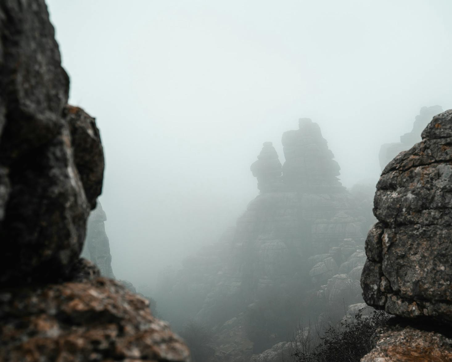
El Torcal de Antequera
If you want to see some truly amazing karst landscapes then you should come to the El Torcal de Antequera which has some of the best sights in all of Europe. The area is also protected since it is home to lots of wildlife, so the trails here make for some great family hikes. Mountain goats are most common but other creatures live in the habitat as well.
Once you reach the car park you will have three paths that you can choose from. The first one begins near the top of the parking lot and spans 7.1 kilometers so you should expect to be hiking for a bit over 3 hours. The other paths are shorter and start at the bottom of the parking lot and will take 45 minutes and two hours to complete. As for getting to the trail, you will have to drive for about an hour. Be sure to have a fabulous Malaga brunch before coming here!
Mirador de las Buitreras
One of our top hiking trail picks in this city is the Mirador de las Buitreras which is about an hour away from El Chorro and is one of the best viewpoints in Malaga. There are no security rails set up in the area and if you get close to the edge you will realize that the drop down is immense, so watch your footing and keep some distance from the cliff.
After enjoying the scenic sights of the lakes and mountains beyond you can either follow the same trail back or continue on the path, although most people say that it is confusing and hard to follow. If you are worried you should pack a map just in case you get lost. The hike takes between 2 to 4 hours, depending on which way you choose to go back, and if you are up for some more outdoor activities you can make your way to the nearby Pico del Convento or the Arabic Staircase trek. This trail is an hour away from Malaga by car.
Pico del Cielo
You will find this hike in the Sierras of Tejeda, Almijara and Alhama Natural Reserve which is in the same mountain range as La Maroma. Overall, this path begins fairly easily and is not too challenging, although the last 400 meters ascend quickly and it gets really steep. This part will require some intense climbing but if you stick it out you will be rewarded with a truly incredible view.
On top, you will get an unobstructed 360 degree view of the Malaga coast on one side and mountain peaks on the other. The total height of the peak is about 1508 meters and you will experience an elevation gain of about 1400 meters, so although this isn't one of Malaga's most challenging hikes, for the most part, it is definitely not easy. The whole trail is about 20 kilometers and can take up to 6 or 7 hours. Pico del Cielo is about an hour and a half car ride away from the center of the city.
Ribera del Guadiaro
For an easier but still gorgeous hike in Malaga make your way to the Guadiaro River which is where the route starts for the Ribera del Guadiaro. The path connects two villages, the Estación de Benaoján and the Jimera Estación, and is part of the Gran Senda de Málaga. Your hike will bring you to the Monte de las Viñas and will take you through some beautiful forest paths.
Make sure to bring a camera so you can capture the views of the Angosturas del Guadiaro valley and the mountain peaks of the Sierra Grazalema Natural Park. After exiting the forested part of the trail you will get to see the impressive peak of Martín Gil which is one of the highest points in the Sierra de Líbar at 1,400 meters high. The trail is mostly flat and easy to navigate but it will take almost two hours to get there.
Easy Hikes in Malaga
Ribera del Guadiaro
Since the paths on the Ribera del Guardiaro aren't steep they are easy to walk along and make a hike that is suitable for anyone.
El Torcal de Antequera
This hike has several paths that you can choose to follow, including some that are shorter and easier making for great family outings.
Intermediate Hikes in Malaga
Pico del Cielo
Most of this hike is easy to follow but the climb does get intense near the end, so if you want an intermediate hike with a bit of a challenge you should give Pico del Cielo a try.
La Maroma
The hikes on La Maroma are long but you will have several trails to choose from, so you can follow the path that best suits your experience level.
Difficult Hikes in Malaga
La Concha
La Concha is a beautiful route but it does get difficult to navigate since there are steep ascents and descents, which is why you should not attempt it if you are not an experienced hiker.
Fuente del Esparto
With uneven terrain, high elevation levels and also the fact that the entire route runs for about 18 kilometers, this is a difficult hike and you should be prepared before trying it.
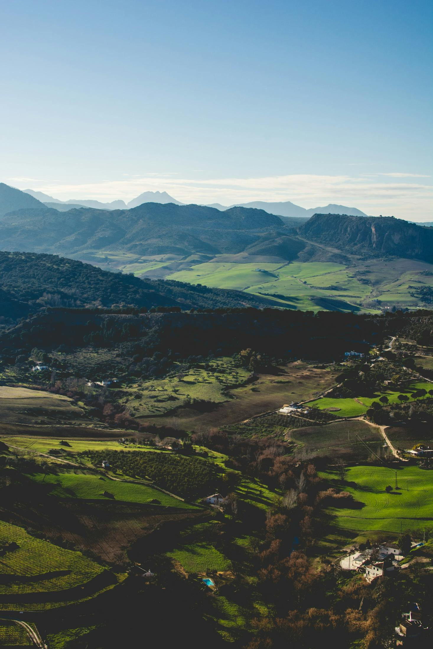
Visiting Malaga and its Best Hiking Trails
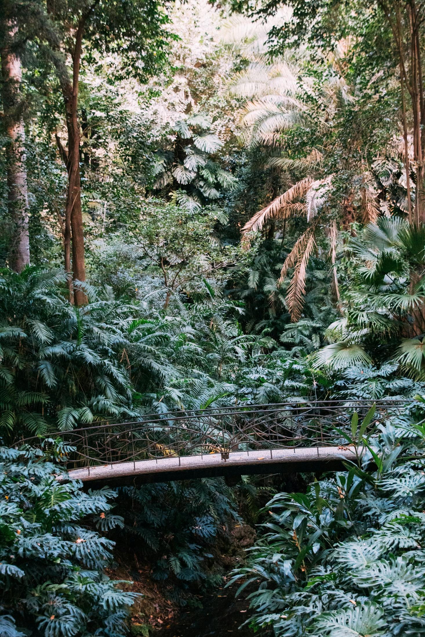
From beautiful mountain peaks in the Montes de Malaga and cliffs like the El Cantal, there are some truly amazing sights in this Spanish city. Your adventures through the wilderness will bring you anywhere from trails through pine trees and lush vegetation to paths over a wooden bridge crossing a river.
If you happen to complete all of these hikes and want to try more you can check out the El Candado club, the trails at Plaza de la Merced, the Castillo de Gibralfaro loop or the trails in the Sierra de las Nieves and the Serrania de Ronda area. The hikes here are beautiful but do take a while to navigate so make sure you bring everything that you need like water, food, a map, a first aid kit and sun protection.
Love discounts and traveling?
Sign up for our newsletter and get 10% off your next booking.