The 6 Best Hikes In Bologna
Bologna, the capital of the Emilia Romagna region in Northern Italy, is known to be an outdoor lover's dream, especially if you love hiking. The Bologna hills are full of hiking trails that will please most hikers, and while many of them are intermediate, they can be good for beginners too if you know how to take your time. The city of Bologna also has a plethora of parks where you can enjoy the walking trails, hit the sports courts, and do other outdoor activities.
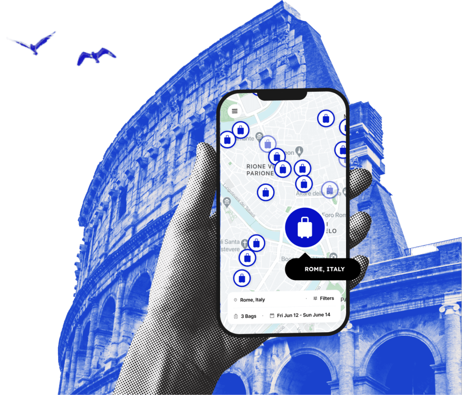
But you surely don't want to be hauling your luggage around the Bologna hills, so before you hit the "Roman Road" store your luggage with a Bologna luggage storage service. This way you can take your time exploring the best hiking trails Bologna has to offer.

Love discounts and traveling?
Sign up for our newsletter and get 10% off your next booking.

Our Top Hiking Trail Picks in Bologna
With so many trails to choose from it can be hard to pick the right one, so we put together a list of the top hiking trails and walks in and around Bologna.
Trail 904
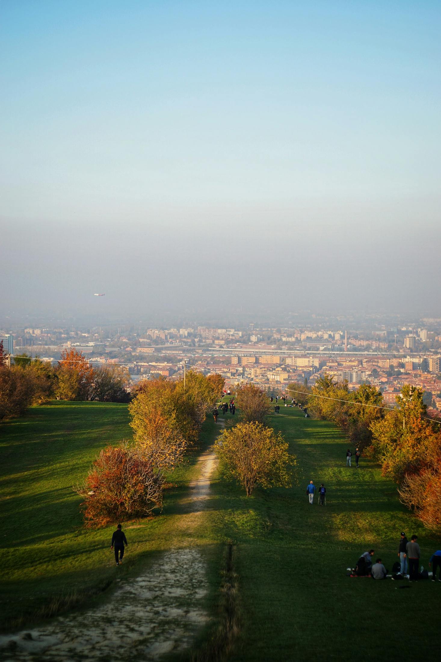
The 904 trail is an easy to moderate hike depending on your fitness level. It is a loop that starts officially at Porta San Mamolo, a medieval gate in the city walls that has been demolished, but you may have to walk a little to get there. The first part of the hike is up a fairly steep road to the Parco di Villa Ghigi, where you will have a good view of the city. The walk goes around the park but you can cut through for a shorter walk, which will make you miss the small Church of San Paolo.
You will, however, not be able to miss Eremo di Ronzano on the top of the hill in Parco di Villa Ghigi. It's a great place to wander through the chestnut, oak, and cypress trees. You are able to go in and look at the frescos too if the church is open. Continue walking until you reach the 8th century Church of San Michele di Gaibola, another great place to have a look around before returning to Porta San Mamolo.
The hike is over 8 miles long and may take you about 3 hours, depending on how long you stop at certain points. If you want a longer hike, you can skip going to the Church of San Michele di Gaibola and go around the San Michele hills to Parco di Forte Bandiera which will add about 2 miles to the hike. From there, you can take public transit back to Bologna or walk the additional 3.5 miles.
Villa Spada to the Basilica of San Luca
Just by looking at the Basilica of San Luca, you know this is not going to be an easy-rated hike. This intermediate hike is just over 6 miles long with some hills to climb and takes around 4 hours to complete (depending on stops). Most of the walk will be paved but you can go "off-road" to check out some of the great views it will afford you.
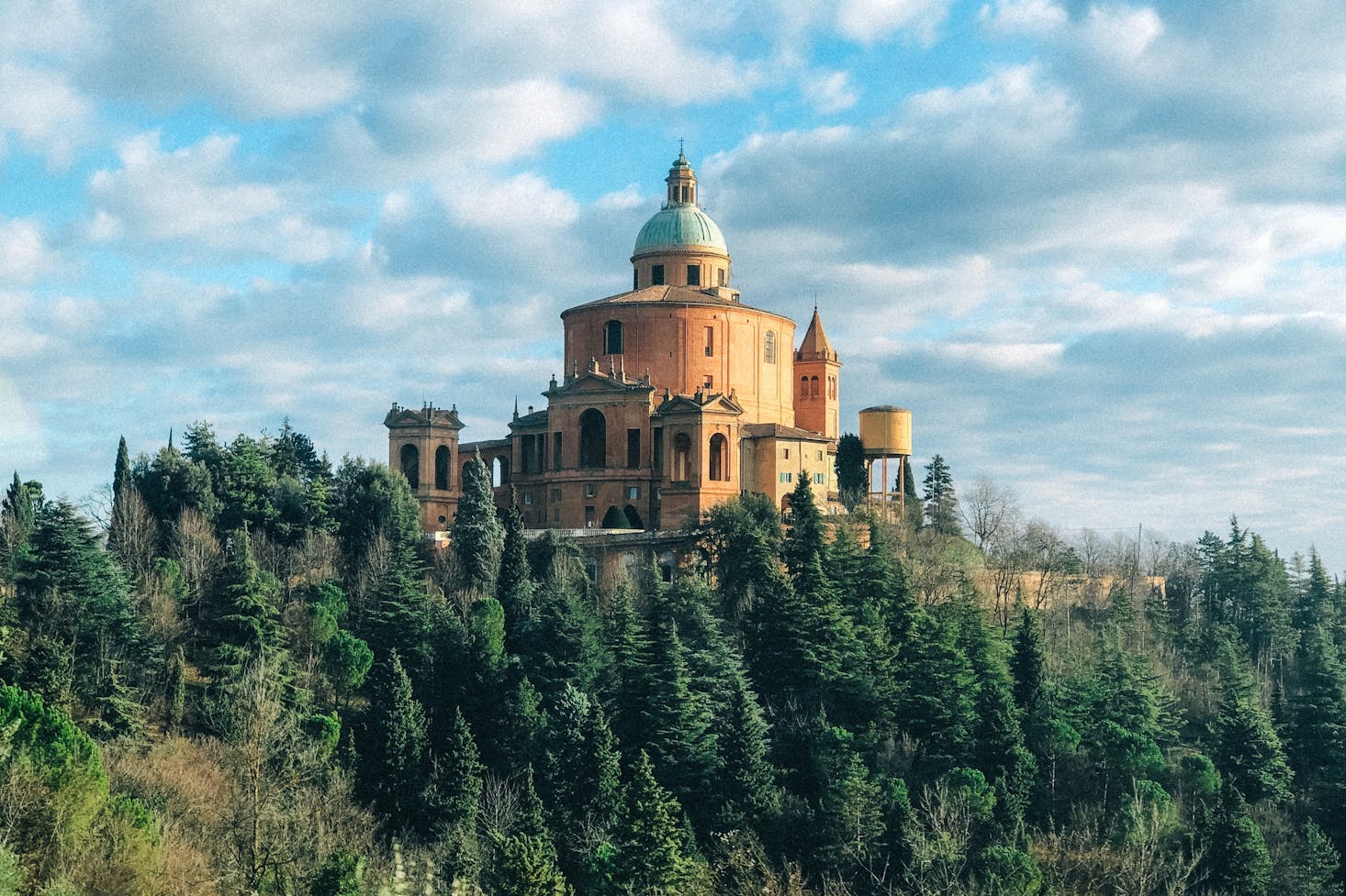
Starting at the 18th-century Villa Spada it is uphill to Parco di San Pellegrino where you will have a spectacular view of Bologna and the surrounding hills. Even more impressive is the view of the Sanctuary of the Madonna di San Luca, the most important building in Bologna and your next destination. When you reach the Sanctuary of the Madonna di San Luca on the top of Colle della Guardia, you can get back into the city center one of two ways: take the number 20 bus or walk.
If you decide to walk, you will be descending through 666 arches of the portico, the longest in the world. The two-and-a-half-mile stretch can be quite busy as it is the most important pilgrimage in Bologna.
Trail 902
This is actually the first official trail of Bologna which starts at Giardino Remo and goes to the Church of San Michele in Bosco. It is a relatively easy hike but begins by walking uphill. Once at the top you will have some fantastic views of the Bologna hills and the city itself.
When you reach the monastic building of San Michele in Bosco, take time to explore the interior. The historical church has been used as military barracks, a prison, a hospital, and even as a royal residence for the King of Italy. Make sure to check out one of the coolest optical illusions called the 'Cannacchiale' (telescope), as you walk away from the hall window the Torre Asinelli (one of the "Two Towers") gets larger.
The rest of the hike is on and off roads and dirt trails until you get to Parco di Forte Bandiera. You can turn around and head straight back, but why? Parco di Forte Bandiera is a great place to take a break, rows of trees, grassy meadows, a wooded area, and in the Spring the blooming flowers make for an ideal rest area.
The out and back trip takes around 3 hours unless, of course, you spend more time admiring the great views.
Certosa Cemetery to Parco della Chiusa
This hike is one of the favorites among Bolognese hikers. It is not too long and is perfect for a little afternoon trek. Out and back will take about an hour and a half. Starting at the Certosa Cemetery, follow the canals that at one time were the key to the success of Bologna. Today they are nice to walk beside enjoying the sound of the water. The water flow is controlled at la Chiusa in Casalecchio di Reno and is one of the oldest hydraulic works in the world.
Once you reach Talon Park (Parco della Chiusa) you can relax and enjoy the huge park or explore the 15th-century palace of the Marquis Talon Sampieri before heading back to the city center. When you get back to the start, take time to visit the Certosa Cemetery, which is one of the largest and oldest in Europe. It is not just a graveyard, it is a large and interesting museum as well, just a very quiet one. Or you can take the one-mile forested Bregoli's Path to go to the Sanctuary of San Luca.
Via Degli Dei
This hike is a bit of a cheat as it goes from Bologna to Florence. Over 80 miles long Via Degli Dei, or Path of the Gods Italy), is a true trek that you do over a five to six-day stretch. If you try to do it in just five days you may find the last stretch a push as you will be walking for almost 11 hours. And even as long as the hike is, it is still considered an easy walking trail. You won't be at sea level the entire time though, as there are some mountains like Monte Venere and Monte Lucario to traverse.
You will walk along the Flaminia Military Roman Road that will pass quaint Tuscan farmhouses in rural areas as well as many villages. The ancient road was built to connect Bologna to Rome but today is a favorite of the many hikers that enjoy hiking along the path from Bologna to Florence, whether in shorter sections or the entire distance. You can even take some side trips like going to Lake Suviana for some watersports activities.
By taking a guided tour of the Path of the Gods Italy, you will not only follow the ancient tracks of the Romans, but get knowledgeable information about the sights like the Roman Aqueduct, where to get the best food, and where to stay. The guides can also help you pick the right energy snack and give advice on how to keep water cool on warmer days. They will also maintain a comfortable hiking pace to ensure no one gets too tired.
The last section of the Path of the Gods Italy, (from Bologna to Florence), normally starts at the Futa Pass and, although the hike officially ends at Piazza della Signoria, many hikers choose to end before that as the area is very busy with tourists. If you are searching for Path of the Gods Italy, you could get the wrong one as there is another Path of the Gods Italy on the Amalfi Coast in Southern Italy, also named Via Degli Dei, and it is only 4 miles long.
Madonna dei Fornelli Out and Back
Just to the south of Bologna, about an hour and a half drive, you will Madonna Dei Fornelli, a lovely village in the hills, and the starting point for this hike. The trail is actually part of the Via Degli Dei but a little reversed. Instead of heading south, you go north towards Badolo, but not the entire 14 miles. The almost immediate uphill climb will take you to the top of the hills which provide fantastic sweeping views of the surrounding area of Emilia Romagna.
Because this is an established trail, you can go as far as you like making it a day trip or just a few hours walk. Build up your appetite and then head back to the city for Bologna street food.
Easy Hikes in Bologna
Although Bologna is surrounded by hills and there are a few in the city, the majority of walking and hiking is pretty easy. If you don't enjoy walking alone consider taking a guided tour like the Old Town walking tour, where you can see Bologna's key landmarks like Piazza Maggiore, the Two Towers, Bologna museums and more. There are plenty of tours to choose from, you will get to see all the best sights and chat with other hikers too.
You can also walk the 40 miles of porticos in Bologna, which are not completely connected, meaning you can spend a few days exploring all of them. If you are wondering why the city has so many porticos, it was due to a housing shortage when in the 12th century the university town was bombarded with 2000 students. They built rooms over the streets and as a side effect it kept the rain off of passersby, so they kept building them.
Intermediate Hikes in Bologna
The most famous and popular hike in Bologna is actually a hermitage to the Sanctuary of San Luca. The two-and-a-half-mile hike starts at the Two Towers near Piazza Maggiore. It is easy walking when you hit Porta Saragozza, but the uphill climb to the Sanctuary of San Luca gets quite steep, which requires a modest fitness level. If you want to walk the 666 arches of the portico you can always take a bus up and walk back.
For a little more variety and to get out of the city, the hiking trails around the Bologna hills are all rated intermediate due to the uphill climbs. But they are not extremely taxing and every one of them is worth the effort.
Difficult Hikes in Bologna
There is one really difficult hiking route near Bologna, and if you are up for the challenge the rewards are incredible. The 5 Valli Eliminator was created for an off-road event that took place in 2020 and is now used by hikers and mountain bikers. It is a multi-day 85.5-mile loop that will take you up some of the tallest mountains in the area. The route is hard but the views are epic.
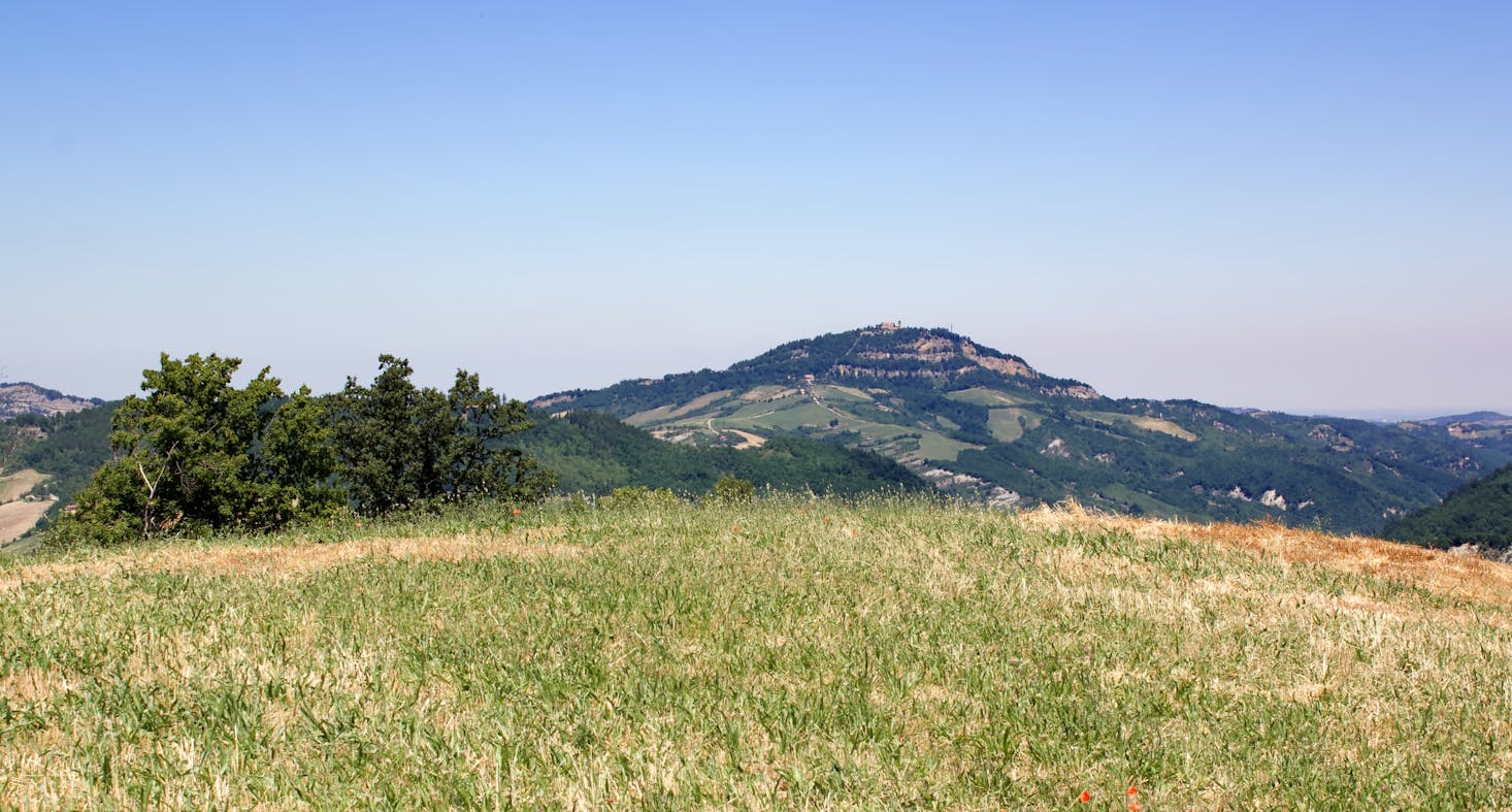
Bologna Hills
While Bologna does not have a lot of official hiking trails, what this locale offers is quite spectacular with breathtaking views and historical treasures along the routes. And beware that a lot of the trails are not clearly marked, so make sure you visit the Bologna Tourist Office to get more information. Another great idea is to download some hiking maps. They will make sure to keep you on the right track on your active vacation in Bologna. Flying into Bologna Airport? Start Before you land, start working on your hiking itinerary!
Love discounts and traveling?
Sign up for our newsletter and get 10% off your next booking.